Most photographers travel to get their images, sometimes to a nearby town, other times to the other side of the globe. But how do you know when that Barvarian castle is going to be in the best light? I use an app called Light Trac. Basically you punch in the name or address, the date, and it will show you exactly which direction the sun will rise and set using colored lines on a google map. I love the slider at the bottom. You just push this left or right to scroll through the times of the day, and the app will move the sun angle line to show you exactly where the sun is at that time of day. Here is my workflow to determine the exact time and side of the castle to be on months from now!
1. Using google type in the location you are photographing. Google will show you the address, as well as photos and a map of the spot.
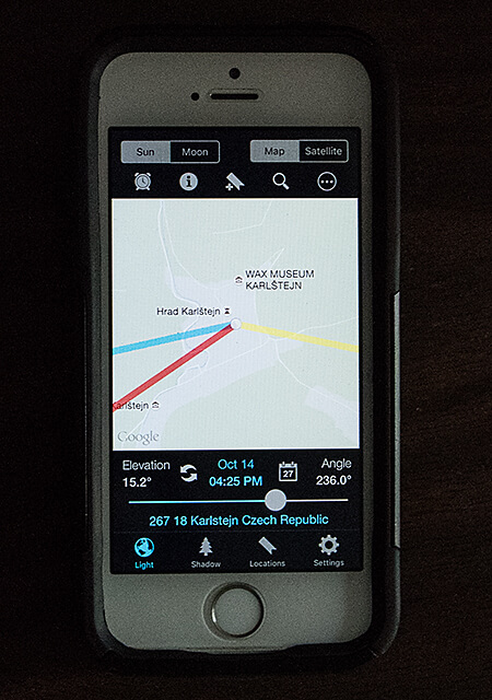
2. Type in the exact address into Light Trac and hit search to find the location. Now you have a google map the app uses, similar to the one you are using on your computer.
3. If I can’t tell enough detail from the google street map, I hit the link to see the location on google earth. Then I zoom in to see the exact orientation of the castle.
4. Using this detailed map and the nearby roads for orientation, I can now match perfectly a certain part of the castle to what the Light Trac app is showing as the sun angle.
That is all there is to it. If I am going to a new European city or national park with a iconic feature, I’ll check the light angles and best times using the method above. Getting the ‘lucky’ shot always favors the prepared!